Overview

UrbanSyn is a diverse, compact, and photorealistic dataset that provides more than 7.5k synthetic annotated images. It was born to address the synth-to-real domain gap, contributing to unprecedented synthetic-only baselines used by domain adaptation (DA) methods.

UrbanSyn White Paper

Reduce the synth-to-real domain gap

UrbanSyn dataset helps to reduce the domain gap by contributing to unprecedented synthetic-only baselines used by domain adaptation (DA) methods.

Open for research and commercial purposes

UrbanSyn may be used for research and commercial purposes. It is released publicly under the Creative Commons Attribution-Commercial-ShareAlike 4.0 license. For detailed information, please check our terms of use.

Ground-truth annotations

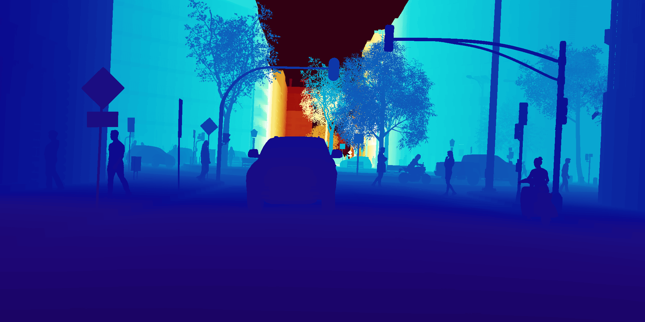
UrbanSyn comes with photorealistic color images, per-pixel semantic segmentation, depth, instance panoptic segmentation, and 2-D bounding boxes. To see some examples of per-pixel ground-truth, please check our examples of annotations.

High-degree of photorealism

UrbanSyn features highly realistic and curated driving scenarios leveraging procedurally-generated content and high-quality curated assets. To achieve UrbanSyn photorealism we leverage industry-standard unbiased path-tracing and AI-based denoising techniques.

Annotations (Ground-Truth)

UrbanSyn brings per-pixel ground-truth semantic segmentation, scene depth, instance panoptic segmentation and 2-D bounding boxes. Check some of our examples:

Semantic Segmentation

Download

The UrbanSyn dataset is provided free of charge to academic and non-academic entities to support research, scientific publication, teaching, but also for commercial purposes.

Remember to check our terms of use. If you find the UrbanSyn Dataset useful for your work, we kindly ask you to cite our white paper.

Data Size Details Links
RGB Images 21 GB The images have a resolution of 2048 * 1024 and are encoded in png format. [Mirror 1] [Mirror 2]
Semantic Segmentation 386 MB The data is stored in grayscale format using the 19 cityscapes ids for training. [Mirror 1] [Mirror 2]
Semantic Segmentation (Color) 392 MB The data is stored in RGB using Cityscape's color convention. [Mirror 1] [Mirror 2]
Depth 59 GB The depth is saved in EXR format with 32 bits (float) per channel. The measurement units are 1e5 meters. [Mirror 1] [Mirror 2]
Panoptic Instance Segmentation 102 MB These labels are provided only for dynamic classes (vehicles, riders and pedestrians). [Mirror 1] [Mirror 2]
Bounding Boxes 6 MB These labels are provided only for dynamic classes (vehicles, riders and pedestrians). [Mirror 1] [Mirror 2]
Camera metadata 1 KB Camera parameter information [Mirror 1]

Urbansyn is also available in Hugging Face

How to use it

  • RGB:

    Contains RGB images with a resolution of 2048x1024 in PNG format.

  • SS:

    Contains the pixel-level semantic segmentation labels in grayscale (value = Class ID) and color (value = Class RGB), respectively, in PNG format. We follow the 19 training classes defined on Cityscapes.

  • Panoptic:

    Contains the instance segmentation of the dynamic objects of the image in PNG format. Each instance is codified using the RGB channels, where RG corresponds to the instance number and B to the class ID. Dynamic objects are Person, Rider, Car, Truck, Bus, Train, Motorcycle and Bicycle.

  • bbox2D:

    Contains the 2D bounding boxes and Instances information for all the dynamic objects in the image up to 110 meters of distance from the camera and bigger than 150 pixels. We provide the annotations in a json file with the next structure:

    • bbox: provides the bounding box size determined by the top left corner (xMin, yMin) and Bottom right corner (xMax, YMax).
    • color: corresponds to the colour of the instance in the panoptic instance segmentation map inside panoptic folder.
    • label: defines the class name
    • occlusion_percentage: provides the occlusion percentatge of the object. Being 0 not occluded and 100 fully occluded.

  • Depth:

    Contains the depth map of the image in EXR format with 32 bits (float) per channel. The units are 1e5 meters.

White Paper

UrbanSyn is described in detail in the white paper:

All for One, and One for All: UrbanSyn dataset, the third Musketeer of Synthetic Driving Scenes, Jose L. Gómez, Manuel Silva, Antonio Seoane, Agnés Borrás, Mario Noriega, German Ros, Jose A. Iglesias-Guitian, and Antonio M. López, arXiv:2312.12176 [cs.CV] https://arxiv.org/abs/2312.12176

When using or referring to the UrbanSyn dataset in your research, please cite our white paper:


@misc{gómez2023one,
title={All for One, and One for All: UrbanSyn Dataset, the third Musketeer of Synthetic Driving Scenes},
author={Jose L. Gómez and Manuel Silva and Antonio Seoane and Agnès Borrás and Mario Noriega and Germán Ros and Jose A. Iglesias-Guitian and Antonio M. López},
year={2023},
eprint={2312.12176},
archivePrefix={arXiv},
primaryClass={cs.CV}
}

Changelog

Changes made in the dataset and web repository:


23/07/2024 - The webpage incorrectly stated that the units for the depth map were 10e-5 meters, when the correct units are actually 1e5 meters. We thank Victor Kallenbach for reporting this error regarding the depth unit scaling.

Terms of Use

The UrbanSyn Dataset is provided by the Computer Vision Center (UAB) and CITIC (University of A Coruña).

UrbanSyn may be used for research and commercial purposes, and it is subject to the Creative Commons Attribution-Commercial-ShareAlike 4.0. A summary of the CC-BY-SA 4.0 licensing terms can be found here.

Due to constraints from our asset providers for UrbanSyn, we prohibit the use of generative AI technologies for reverse engineering any assets or creating content for stock media platforms based on the UrbanSyn dataset.

While we strive to generate precise data, all information is presented 'as is' without any express or implied warranties. We explicitly disclaim all representations and warranties regarding the validity, scope, accuracy, completeness, safety, or utility of the licensed content, including any implied warranties of merchantability, fitness for a particular purpose, or otherwise.

Privacy Policy

Urbansyn.org uses Google Analytics to collect data. We need this data to understand how you use our website so we can improve its design and functionality.

With your consent, Google Analytics will process and collect your personal data (cookies and IP address) to give us valuable information. Google Analytics will transfer your data to the United States and store it for 2 months. To learn more about Google's data transfer policies, click here.

Standard contractual clauses are legal clauses written by the European Commission. They are part of a contract between Google Ireland Ltd. and Google LLC, and Google LLC must follow them. Standard contractual clauses tell Google LLC what it can and cannot do with your data

You have certain rights over your data: for example, you can require us to delete them or to provide you with a copy. We take responsibility for the processing of your data. We are available to answer any question and handle any request from you. Please use contact@urbansyn.org if you we want to get in touch with us.

Contact

If you have any questions about the dataset, please feel free to contact us using this email: contact@urbansyn.org

Acknowledgements

  • Funded by:
  • Grant agreement PID2020-115734RB-C21 "SSL-ADA"

    Grant agreement PID2020-115734RB-C22 "PGAS-ADA"

  • Personal acknowledgments:
  • Antonio M. López acknowledges the financial support to his general research activities given by ICREA under the ICREA Academia Program. CVC's authors acknowledge the support of the Generalitat de Catalunya CERCA Program and its ACCIO agency to CVC’s general activities.

    Jose A. Iglesias-Guitian acknowledges the financial support to his general research activities given by UDC-Inditex InTalent programme, the Spanish Ministry of Science and Innovation (AEI/RYC2018-025385-I funded by MCIN/AEI/10.13039/501100011033 and UE/FSE), and Xunta de Galicia (ED431F 2021/11, EU-FEDER ED431G 2019/01).

    UrbanSyn would have not been possible without the help of other people. We would like to send special thanks to: Peri, Dani, Cris, Guillem and Mario. We also extend our gratitude to RenderPeople for granting permission to utilize their 3D pedestrian models in the development of this dataset, and to Side Effects Software Inc. for generously providing Houdini licenses that facilitated the development of this work.

  • Developed by: